
Strata Management in Long Beach NSW 2536
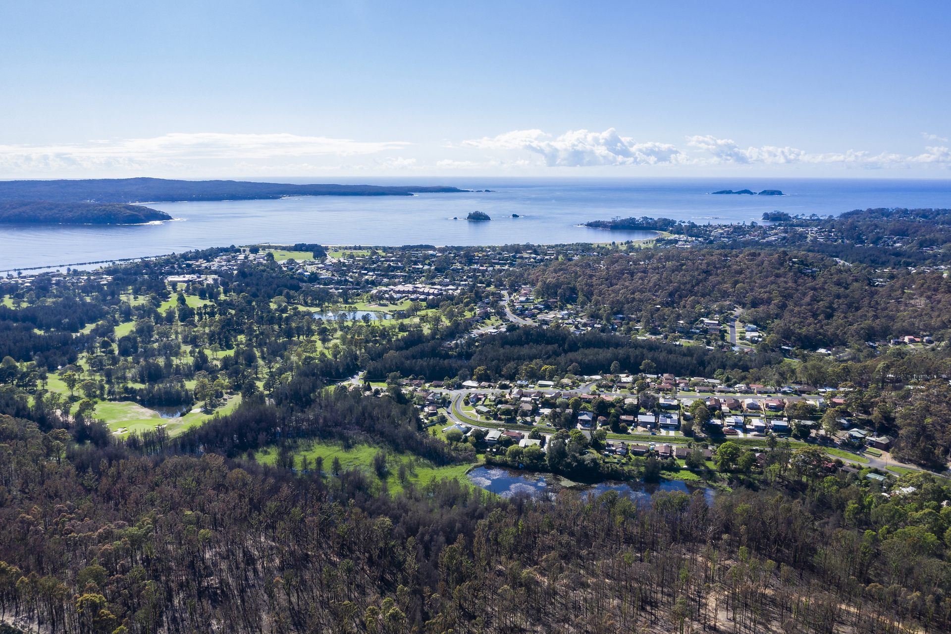
Long Beach is a peaceful coastal suburb of Batemans Bay on the NSW South Coast, known for its relaxed lifestyle, natural bushland surrounds, and easy access to pristine beaches. Popular with families, retirees, investors, and permanent residents, Long Beach offers a quiet coastal setting while still being just minutes from Batemans Bay and essential local amenities.
Long Beach Strata Management
Strata Management for Long Beach Villas Townhouses and Community Schemes
Long Beach occupies the northern side of Batemans Bay, with residential streets extending between the shoreline, Long Beach Lagoon and bushland near Cullendulla Creek Nature Reserve. Villas, townhouse groups and community title properties in this setting need management based on their own plans, access arrangements, drainage and shared infrastructure.
Essential Strata provides management for Long Beach schemes through its Batemans Bay local office. The office page is the correct place for the manager profile, street address, enquiries, service details, fees and proposal process. This page deals with Long Beach property conditions and local resources so it answers a narrower search.
The starting point for each scheme is its registered strata or community plan, by-laws, insurance information, maintenance history and capital works forecast. Committees can then identify shared roads, driveways, drainage, retaining structures, lighting, landscaping and coastal building elements that require planned attention.
Long Beach Lagoon Flood and Stormwater Planning
Eurobodalla Council's Batemans Bay Urban Creeks Flood Study treats Long Beach Lagoon as its own study area. Council's current floodplain risk management study and plan also includes the Long Beach catchment. These sources explain broader flood behaviour; they do not decide the risk, responsibility or insurance position for an individual property.
A committee should map how water reaches and leaves its common property. Roof outlets, downpipes, pits, driveway grades, swales, garden beds and retaining-wall drainage can affect one another. Water backing up near garages or lower lots may have a different cause from runoff crossing the site after intense rain.
Useful evidence includes dated photographs, rainfall observations, water marks, the time taken for ponding to clear and notes about any surcharge from nearby drainage. Plans and previous consultant reports should remain with the scheme records so later investigations begin with the building's history rather than assumptions.
Bay Road Coastal Erosion and Private Property Duties
Council's Long Beach coastal erosion control project addresses shoreline erosion and the protection of Bay Road. Council records that the work is intended to reduce further erosion, protect road access and retain access to adjoining properties. This is a distinctive Long Beach issue and should remain on this page rather than being repeated across the Surfside or Batemans Bay pages.
Public protection works do not transfer responsibility for private common property. A scheme must still maintain its own building envelope, paths, fencing, lighting, drainage, retaining structures and any assets shown on its plan. Work close to the foreshore, reserve or mapped hazard area may require Council, environmental or specialist advice.
Following severe weather, committees should separate urgent make-safe action from the permanent repair. Temporary barriers, drainage clearing or access controls may be necessary, but lasting work needs a defined scope, the relevant approvals and appropriate technical input. Council's broader Batemans Bay coastal protection works provide current regional context.
Foreshore and Wetland Reserves Near Strata Property
Council has adopted a specific plan of management and landscape masterplan for the Long Beach Foreshore and Wetland Reserves. These are available through its community land information. They describe how public land is intended to be used and improved, but they do not change the boundaries shown on a private strata or community plan.
Schemes near a reserve should keep private fences, gates, paths and landscaping inside the correct boundary. Informal mowing, storage, drainage outlets or vehicle access over public land can create maintenance and approval problems. A survey or title advice may be needed where the physical occupation does not match the plan.
Residents also need a clear distinction between scheme rules and rules applying on Council or National Parks land. By-laws govern the strata property; public authorities control their own reserves, roads and foreshore areas. Signs and resident information should not imply that the owners corporation controls adjacent public space.
Reserve Edges Vegetation and Shared Landscaping
National Parks identifies access to Square Head through Cullendulla Drive and Blairs Road in Long Beach. The official Cullendulla Creek Nature Reserve visitor information helps distinguish the Long Beach access point from the Surfside entrance to Cullendulla Beach.
For schemes beside bushland or wet areas, landscaping should preserve access to gutters, pits, hydrants, service meters and building edges. Dense planting can hold moisture against walls, conceal termite activity or obstruct maintenance. Our termite and pest management guide for NSW strata explains practical inspection and record-keeping steps.
Vegetation removal, pruning and fuel management must follow the strata approval process and any Council, National Parks or bushfire requirements. Council's bushfire-prone land mapping is a research starting point, not a site-specific assessment. Committees should use qualified advice when a tree, slope or mapped hazard may affect proposed work.
Shared Driveways Visitor Parking and Service Access
Long Beach schemes may rely on shared driveways or internal roads for residents, waste collection, trades and emergency access. The registered plan and any community management statement determine the legal arrangement. Committees should keep access widths clear and record who maintains surfaces, drainage, lighting and gates.
Allocated parking, visitor bays and turning areas should be communicated consistently. A public verge or beach access point is not an extension of scheme parking. Where repeated obstruction occurs, the committee should use the by-laws and formal notice process rather than improvised signs or selective enforcement.
Public transport context is available through route 857 between Batemans Bay and Long Beach via Surfside and Maloneys Beach. For the property itself, clear address signs, contractor instructions and emergency access arrangements are more important than copying broad transport wording from the Batemans Bay page.
Capital Works Insurance and Coastal Maintenance
A Long Beach capital works plan should reflect the scheme's real assets and exposure. Likely items may include roofing, gutters, drainage, coatings, metal fixings, windows, paths, retaining structures, shared roads, fencing and common lighting. The plan should not assume that every property has the same coastal maintenance cycle.
Inspection results and recurring faults should be compared with forecast dates and available funds. Work that protects access, controls water or preserves the building envelope may need to be brought forward. Our 10-year capital works fund guide outlines how a committee can connect its forecast with current condition and quotations.
NSW Government guidance on strata finances and insurance explains the general framework. A scheme should notify its insurer or broker when required, retain evidence after an event and avoid assuming that erosion, gradual deterioration or deferred maintenance will be insured.
Local Long Beach and Eurobodalla Resources
Long Beach coastal erosion control for Council information about Bay Road and shoreline protection.
Batemans Bay Urban Creeks Flood Study for Council's Long Beach Lagoon catchment material.
Batemans Bay floodplain risk management project for current flood-planning work affecting Long Beach.
Long Beach Foreshore and Wetland Reserves plans for adopted community-land and landscape documents.
Cullendulla Creek Nature Reserve visitor information for Square Head access through Long Beach.
Route 857 for current public-transport information between Long Beach and Batemans Bay.
Greater Batemans Bay Structure Plan for regional planning context.
Eurobodalla planning considerations for development, flooding and coastal-hazard research.
Strata Support from the Batemans Bay Office
The Batemans Bay team services owners corporations and community schemes in Long Beach. Use the Essential Strata Batemans Bay office page for contact details, the local manager, service and fee information, and the proposal pathway. Keeping those conversion details on one page reduces competition between the office and neighbourhood URLs.
For an initial discussion, a Long Beach committee can provide its property address, lot count, plan type, current agreement end date, recent meeting papers and any immediate concerns involving lagoon drainage, coastal exposure, reserve boundaries, shared access, finance or maintenance.
Frequently Asked Questions About Long Beach Strata
1 What types of schemes may be found in Long Beach
Long Beach is primarily residential. Relevant properties may include villa or townhouse strata, smaller residential schemes and community title developments. The registered plan establishes each lot, common property and shared assets.
2 Does Essential Strata have a Long Beach office
Long Beach is serviced through Essential Strata's nearby Batemans Bay office. Office location, manager, contact, fee and proposal information remains on that page so it does not compete with this neighbourhood guide.
3 Is Long Beach Lagoon included in Council flood planning
Yes. Council's Batemans Bay Urban Creeks Flood Study includes a separate Long Beach Lagoon study area, and the current risk-management work also covers Long Beach. Individual properties may still need site-specific advice.
4 Do the Bay Road protection works cover private common property
No. Council's project protects identified public shoreline and road infrastructure. An owners corporation or community association remains responsible for the assets shown as its common property or association property.
5 Who maintains drainage inside a Long Beach scheme
The answer depends on the plan, the location and purpose of the drainage asset, applicable by-laws or community documents, and the cause of the problem. Investigation should occur before costs are allocated.
6 Can a scheme use an adjoining reserve for parking storage or access
Not without the appropriate right or approval. Public reserve land is separate from the scheme. Committees should check boundaries and obtain advice before using, altering or directing drainage across adjoining land.
7 Who is responsible for a shared driveway or private road
Responsibility follows the registered plan, community management statement, easements and any relevant by-laws. These documents should be reviewed before resurfacing, drainage or access costs are divided.
8 How should coastal water entry be investigated
Record where and when the water appeared, then inspect likely external sources such as roofs, windows, wall penetrations, balcony outlets and drainage. Qualified advice may be needed before responsibility is assigned.
9 How can a Long Beach committee request a proposal
Contact the Batemans Bay team with the scheme address, lot count, plan type, agreement expiry, recent meeting papers and main priorities. Essential can then discuss an appropriate service and fee proposal.